Appia Immersiva The visit
← All stopsStop 07
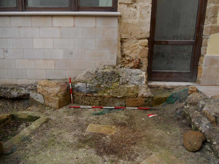
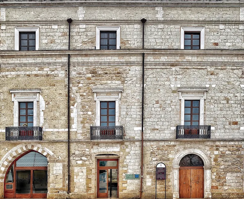
Stone façade of the Casa del Turista, with three levels of windows and arched entrances at ground level.
Photograph supplied for the Casa del Turista stop.

Inner harbour · Brindisi · Stop 07

Casa del Turista.

One place, many eras

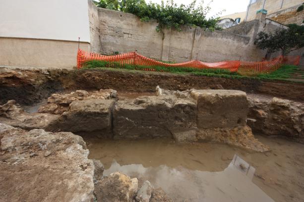
On the Regina Margherita waterfront, the façade of the Casa del Turista conceals a history much older than the present building. Excavations in its courtyard in 1999, 2000 and 2011 documented Roman structures, late antique changes and medieval traces.

Explore the points

A historian’s account

Giacomo Carito on the Casa del Turista

From the waterfront to the excavated courtyard, historian Giacomo Carito explains the San Giovanni dei Greci complex, its relationship with the medieval harbour and the Roman and medieval traces at the same site. An earlier Templar connection remains an interpretation; the plan below distinguishes excavated remains from hypotheses.

Original audio in Italian · English subtitles available · approximately 2 minutes 51 seconds.

Original film: VisitBrindisi.it. Speaker: Giacomo Carito. Opening and corner branding adapted for Appia Immersiva; the City of Brindisi crest appears in the new opening.

Read the Italian video transcript

Nel Medioevo, in prossimità delle cale portuali, erano darsene, ospizi e arsenali degli ordini monastico-cavallereschi. Templari, cavalieri di San Giovanni, teutonici, lazzariti avevano a Brindisi le proprie basi operative funzionali al rifornimento dei presidi cristiani, non solo in Terra Santa, ma anche nei Balcani. Di tutto questo unico relitto, si direbbe, rimane l'ospedale che era dei cavalieri di San Giovanni, ma che probabilmente in precedenza era stato dei Templari. Si tratta del complesso di San Giovanni dei Greci, oggi denominato Casa del Turista. Della chiesa rimangono solo frammenti, una parte del bastamento absidale, perché la chiesa fu demolita per dar luogo al palazzo Cocotò, poi Bono, poi Ina. All’interno del palazzo sono comunque ancora visibili resti della chiesa, perché Cocotò li riutilizzò come elementi nella nuova costruzione.

L'area archeologica che è alle mie spalle è un'area in cui sono presenti elementi dell'età romana, ma anche dell'età medievale, Com’è noto, nel Medioevo si seppelliva nei sagrati, cioè nella terra consacrata intorno alle chiese. Questo giustifica il ritrovamento di sepolture medievali in tutta la parte antica della città. Per altro verso, la presenza di resti romani documenta in modo eloquente l'espansione dell'abitato che si ebbe oltre le mura. Di questo abbiamo un esempio anche lungo via Montenegro, dove all'esterno della cinta fortificata della città si vede bene lo svilupparsi di domus. Il complesso ospitaliero doveva avere un aspetto imponente. Lo descrive molto analiticamente lo storico brindisino Giovanni Maria Moricino,

ma del resto occorre pensare che per i cavalieri di San Giovanni, che poi sarebbero quelli che oggi sono denominati i cavalieri di Malta, Brindisi era una base logistica importantissima. In realtà la scelta di Brindisi trovava ostacoli in Venezia, che non voleva all’imbocco dell'Adriatico la presenza di una grande flotta. Per Venezia il golfo di Venezia cominciava sulla linea ideale che univa Brindisi a Corfù. Oltre quella linea, qualunque presenza di una flotta, veniva considerata ostile. Quindi i veneziani mai hanno voluto l'insediamento di una base militare a Brindisi, tant'è che gli spagnoli alla fine opteranno per una strategia di dissuazione con la costruzione delle grandi fortezze sull'isola di Sant'Andrea, proprio per il veto veneziano relativo alla presenza di una flotta a Brindisi.

Stop 07 · Choose a story

Explore the excavated courtyard

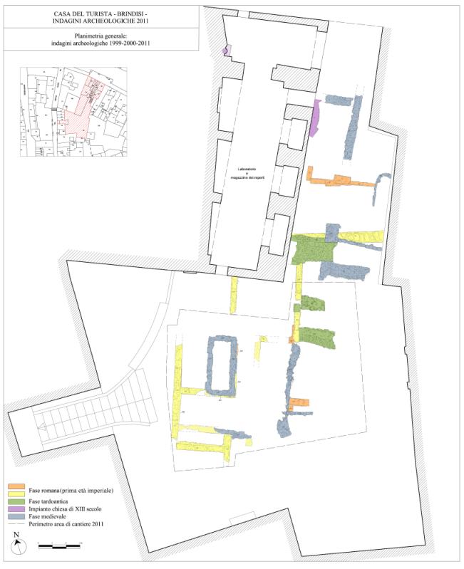
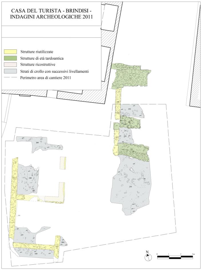
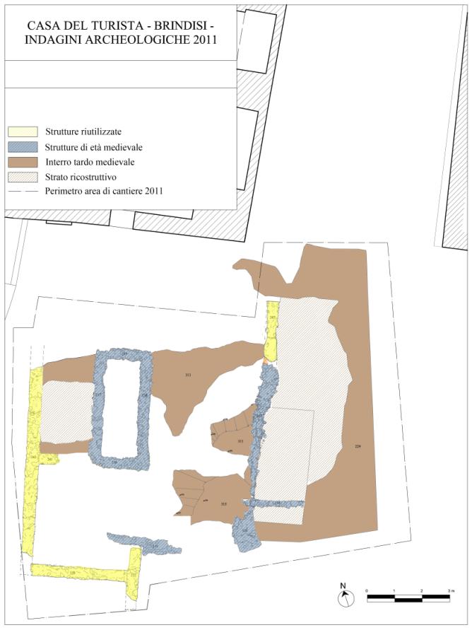
The excavation plan uses different colours for each building phase. Tap a number on the enlarged plan or choose a story from the list. Every point has audio and text.

Explore the enlarged plan

Periodised excavation plan of the Casa del Turista published by Paola Palazzo: the historic building lies to the west and excavated structures in the courtyard are coloured by phase.
The full plan

On a phone, scroll the enlarged plan left or right. You can choose the same stories from the list below.

Paola Palazzo, “Brindisi. Casa del Turista”, 2015, p. 5, fig. 9. The guide adds the numbers to indicate story areas, not find coordinates, GPS measurements or public paths.
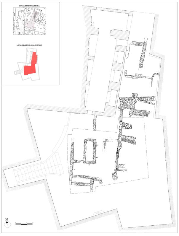
Compare the structures plan
General plan of structures excavated in 1999, 2000 and 2011, published by Paola Palazzo as figure 8.
Paola Palazzo, 2015, fig. 8, p. 5.

Numbered points represent story areas, not the exact location of finds.

Choose a story

  1. 01The Roman walls
  2. 02A new use for the site
  3. 03The basin in the courtyard
  4. 04The burials
  5. 05The church of San Giovanni
01

Story 01

The Roman walls

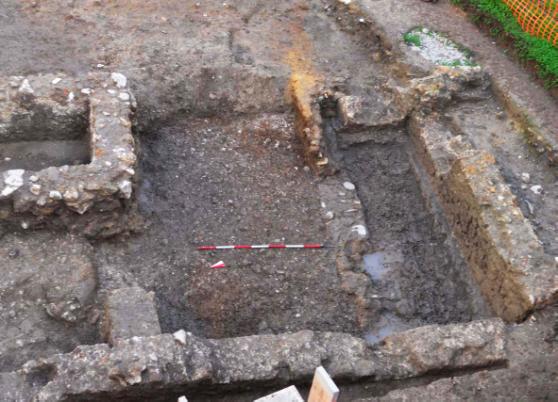
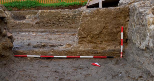
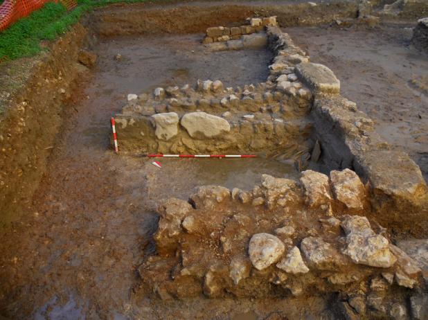
Excavation photographQuadrangular rooms bounded by concrete masonrySource: Palazzo (2015), fig. 11.1

Listen to the guide

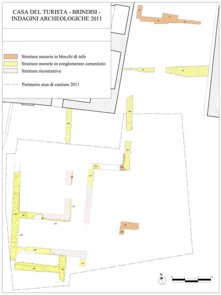
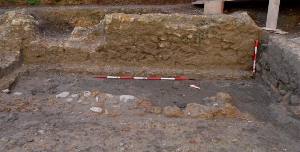
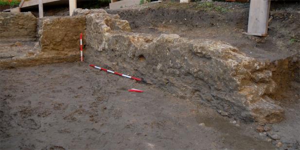
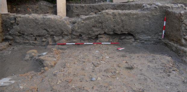
In the western sector, excavators found concrete masonry and squared blocks of local limestone, aligned north–south and east–west.

These are the earliest structures documented here, cautiously dated to the early imperial period.

The nearby harbour makes a commercial use plausible, but the excavation does not establish their exact purpose.

Source for this point: Palazzo (2015), pp. 5-6, figg. 8-14

↑ Back to the plan

Images for this story

PlanPlan of the early Imperial structuresSource: Palazzo (2015), fig. 10
Excavation photographQuadrangular rooms bounded by concrete masonrySource: Palazzo (2015), fig. 11.2
Excavation photographDetail of the Roman concrete masonrySource: Palazzo (2015), fig. 12.1
Excavation photographDetail of the Roman concrete masonrySource: Palazzo (2015), fig. 12.2
Excavation photographDetail of the Roman concrete masonrySource: Palazzo (2015), fig. 12.3
Excavation photographDetail of the Roman concrete masonrySource: Palazzo (2015), fig. 12.4
Excavation photographStructure built with squared carparo stone blocksSource: Palazzo (2015), fig. 13
Excavation photographStructure built with squared carparo stone blocksSource: Palazzo (2015), fig. 14
02

Story 02

A new use for the site

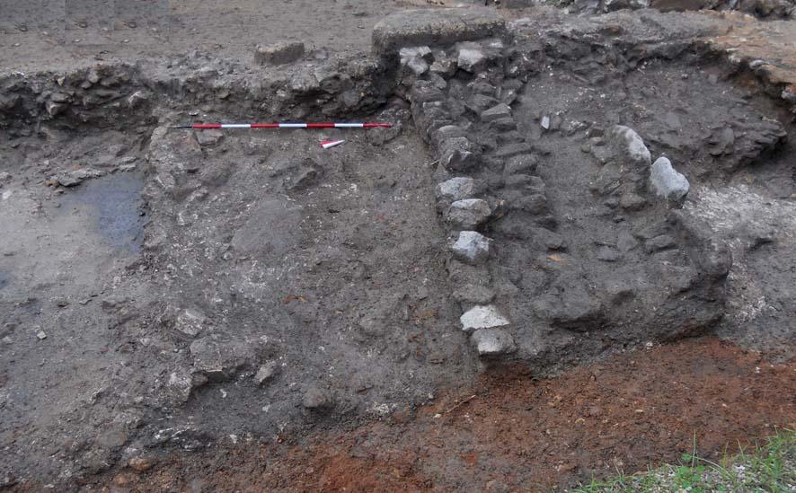
Excavation photographBurnt layer in the eastern sectorSource: Palazzo (2015), fig. 16

Listen to the guide

In the eastern sector, new surfaces were laid over collapse deposits dated to the third and fourth centuries.

Walls built with reused materials, traces of fire and bronze slag belong to the fifth to seventh centuries.

These clues suggest metalworking, but no complete workshop survives to prove the interpretation.

Source for this point: Palazzo (2015), pp. 7-8, figg. 15-18

↑ Back to the plan

Images for this story

PlanPlan of the Late Antique phaseSource: Palazzo (2015), fig. 15
Excavation photographWall sections in the eastern sectorSource: Palazzo (2015), fig. 17
Excavation photographDetail of the burnt and collapsed layersSource: Palazzo (2015), fig. 18
03

Story 03

The basin in the courtyard

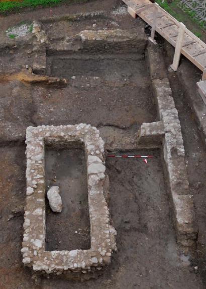
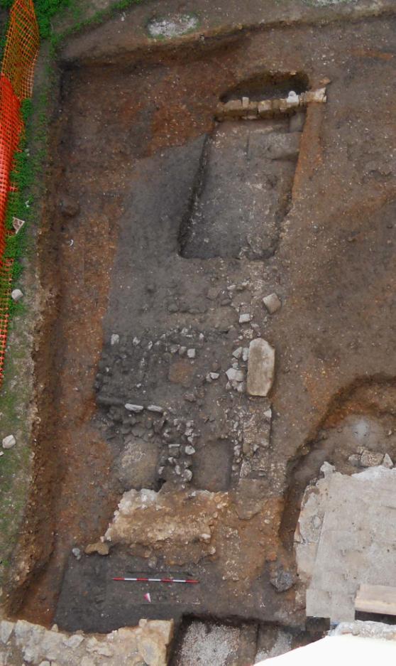
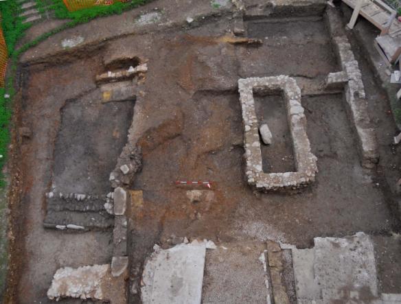
Excavation photographExcavated courtyard seen from aboveSource: Palazzo (2015), fig. 20

Listen to the guide

The medieval courtyard reused some Roman walls.

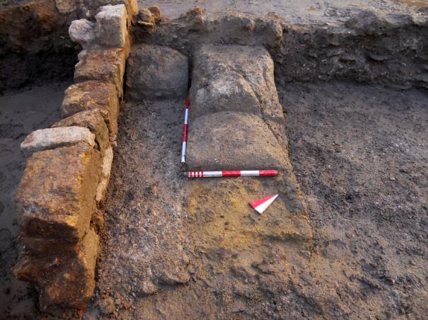
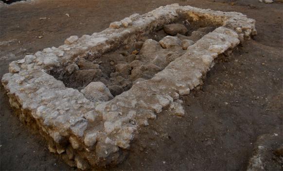
A rectangular structure in its western sector has been interpreted as a basin.

The study suggests it may have been used to slake lime, but its function remains uncertain.

Source for this point: Palazzo (2015), pp. 8-9, figg. 19-23

↑ Back to the plan

Images for this story

PlanPlan of the medieval phasesSource: Palazzo (2015), fig. 19
Excavation photographRectangular structure interpreted as a basinSource: Palazzo (2015), fig. 21
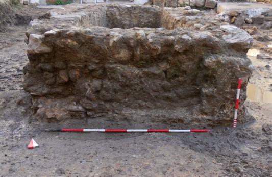
Excavation photographSouthern wall with reused materialSource: Palazzo (2015), fig. 22
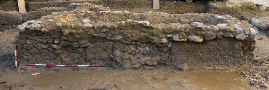
Excavation photographEastern wall built over earlier structuresSource: Palazzo (2015), fig. 23
04

Story 04

The burials

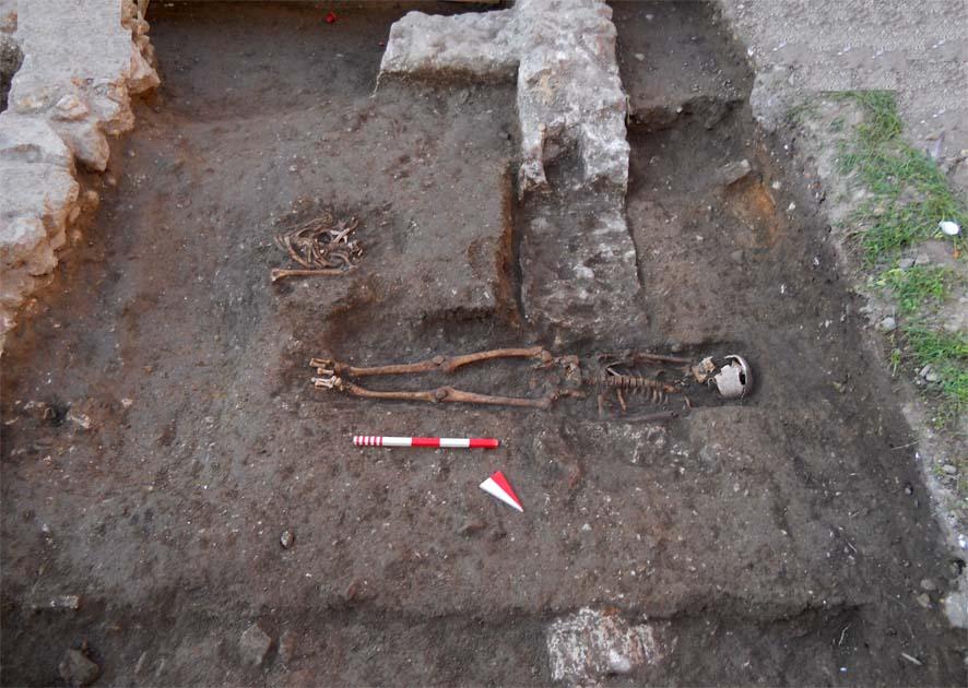
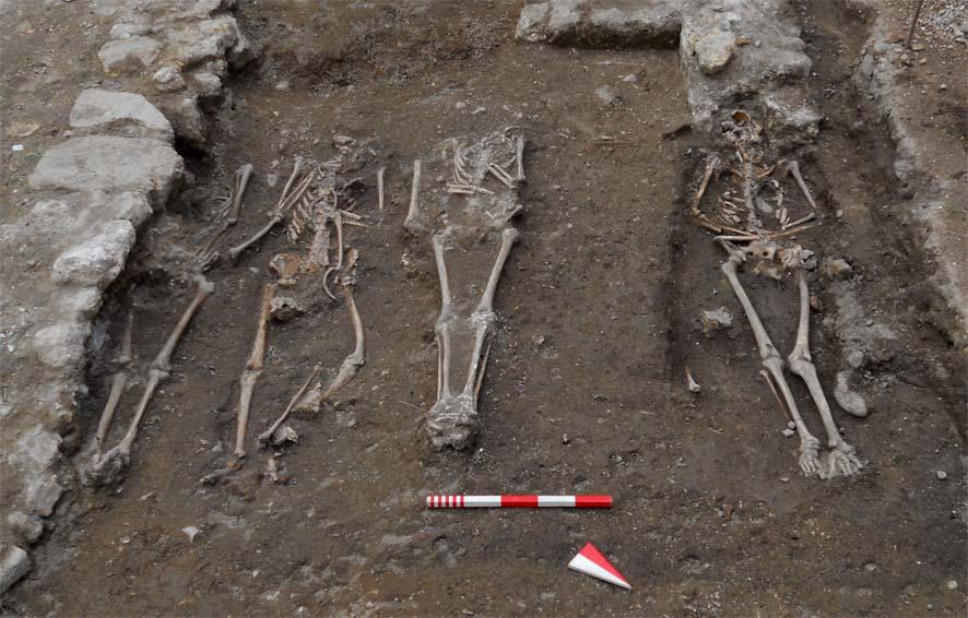
Excavation photographSequence of the earlier burialsSource: Palazzo (2015), fig. 29

Listen to the guide

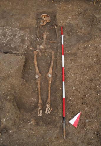
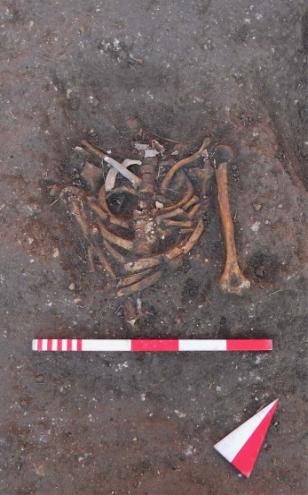
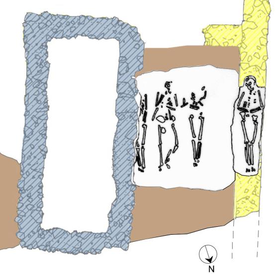
Several phases of burials in simple earth graves were documented in the western part of the excavation.

Some graves cut through older structures: the same ground served different purposes over time.

The burial area seems to have been linked to the church of San Giovanni dei Greci; the individuals' names are unknown.

Source for this point: Palazzo (2015), pp. 11-12, figg. 29-32

↑ Back to the plan

Images for this story

Excavation photographBurial number 6 documented during excavationSource: Palazzo (2015), fig. 30
Excavation photographBurial number 7 documented during excavationSource: Palazzo (2015), fig. 31
PlanPlan of the later burial sequenceSource: Palazzo (2015), fig. 32
Excavation photographLater burials in the western sectorSource: Palazzo (2015), fig. 32 · Photo: G. Membola
05

Story 05

The church of San Giovanni

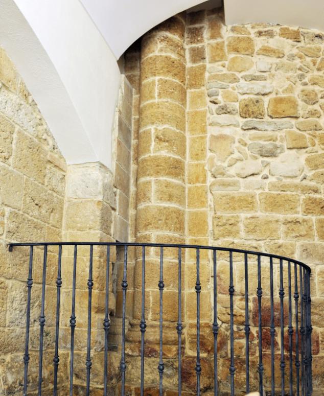
Excavation photographColumn reused in the building's western wallSource: Palazzo (2015), fig. 35 · Photo: G. Membola

Listen to the guide

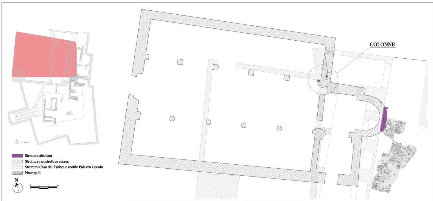
Remains attributed to the church of San Giovanni dei Greci were documented towards the northern sector and in neighbouring buildings.

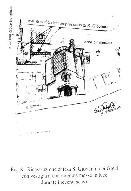
The report identifies part of an apse and a reused column; a church dedicated to San Giovanni appears in a document of 1260.

Its complete ground plan is a scholarly reconstruction, not a building that survives intact today.

Source for this point: Palazzo (2015), pp. 12-13, figg. 33-36

↑ Back to the plan

Images for this story

ReconstructionReconstructed plan of the church of St John of the GreeksSource: Palazzo (2015), fig. 33
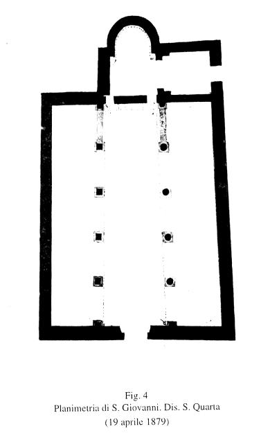
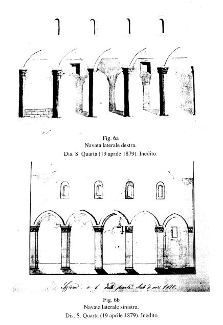
Historic drawingHistoric church plan drawn by Salvatore QuartaSource: Palazzo (2015), fig. 34
Historic drawingHistoric drawings of the church aisles by Salvatore QuartaSource: Palazzo (2015), fig. 34
ReconstructionGraphic reconstruction of the church published by Maddalena CapiferroSource: Palazzo (2015), fig. 34c
Excavation photographRemains attributed to the church apse in the northern sectorSource: Palazzo (2015), fig. 36 · Photo: G. Membola

View the façade from outside. If the courtyard is open, compare the plan with what you can see without entering the excavated areas. Follow the instructions on site.

A digital guide does not guarantee that the courtyard is open.

← All stops
Sources and method

Paola Palazzo, “Brindisi. Casa del Turista”, Fasti Online Documents & Research, 332 (2015), pp. 1–15. Plans in figs. 8 and 9 are reproduced here with reuse authorised by the project commissioner; the original article records a specific concession for its illustrations. Interactive numbers were added by the guide.
The texts distinguish excavated structures from proposed functions. The numbered positions summarise excavation sectors, not geolocated finds. This digital page does not confirm that the site is open.

Audio generated locally with Piper; the text and transcript are available without external services.

The photographs, plans and drawings accompanying these five stories come from figs. 10-23 and 29-36 in Palazzo (2015). Reconstructions are identified as such; the article credits G. Membola for the photographs in figs. 32, 35 and 36.

APPIA IMMERSIVA

Choose your language.

This stop offers five audio stories and texts in Italian, English, French, German and Spanish.

APPIA IMMERSIVA

Reading

Preferences are saved in this browser when local storage is available. They do not change your stop.

APPIA IMMERSIVA

Appia Immersiva · the film

Project film with illustrative reconstructions, not archaeological documentation. You can enable the original audio using the player controls.